Log in
All resources
Create a design
33,528 Free Images of 1632 Maps
university of toronto wenceslas hollar digital collection
maps made in the 17th century
prints by wenzel hollar
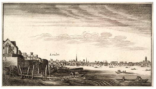
hollar maps and plans of london
files from the bodleian libraries
theatrum orbis terrarum (london 1606)
maps in the library of congress
geographical illustrations by coronelli
atlantis magni tomus quartus (biblioteca comunale di trento)
maps from the mechanical curator collection
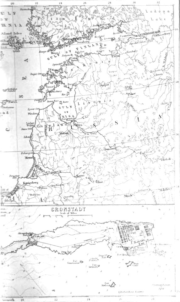
pictorial history of the russian war 1854-5-6 by george dodd
old maps of kronstadt
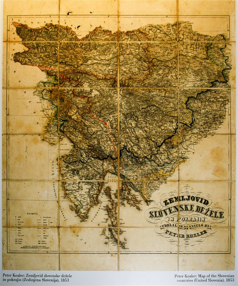
items kept by the national museum of slovenia
february 2008 in ljubljana
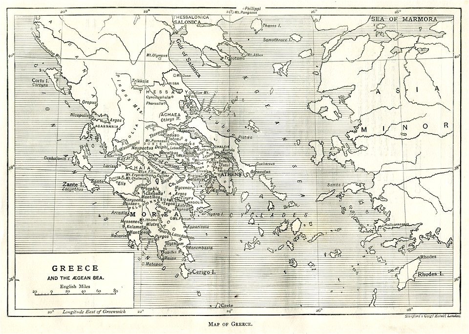
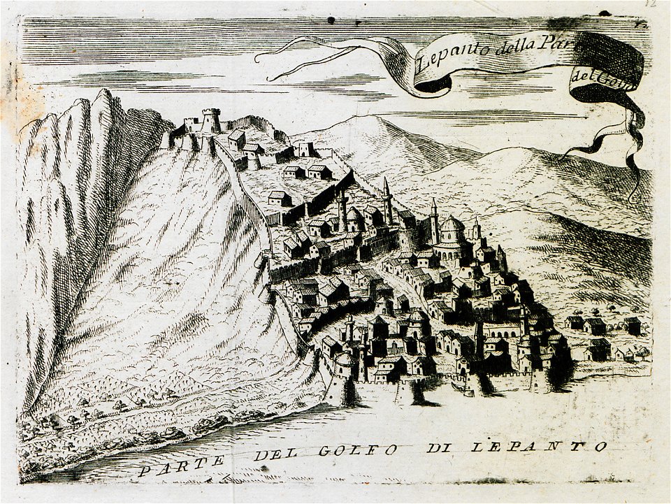
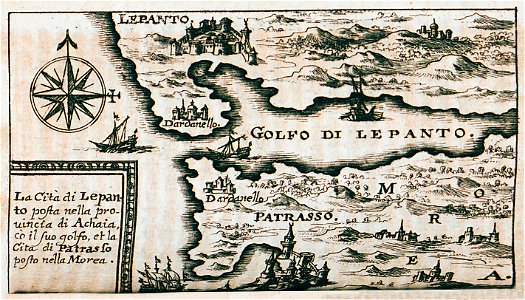
old maps of greece
greek pictures
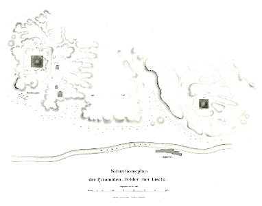
pyramid of amenemhat i
pyramid of senusret i
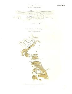
lepsius-projekt - fortifications
lepsius-projekt - maps
geographical illustrations by coronelli
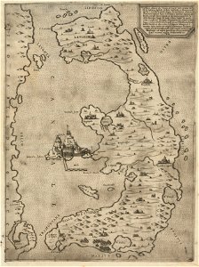
old maps of the peloponnese
atlantis magni tomus secundus (biblioteca comunale di trento)
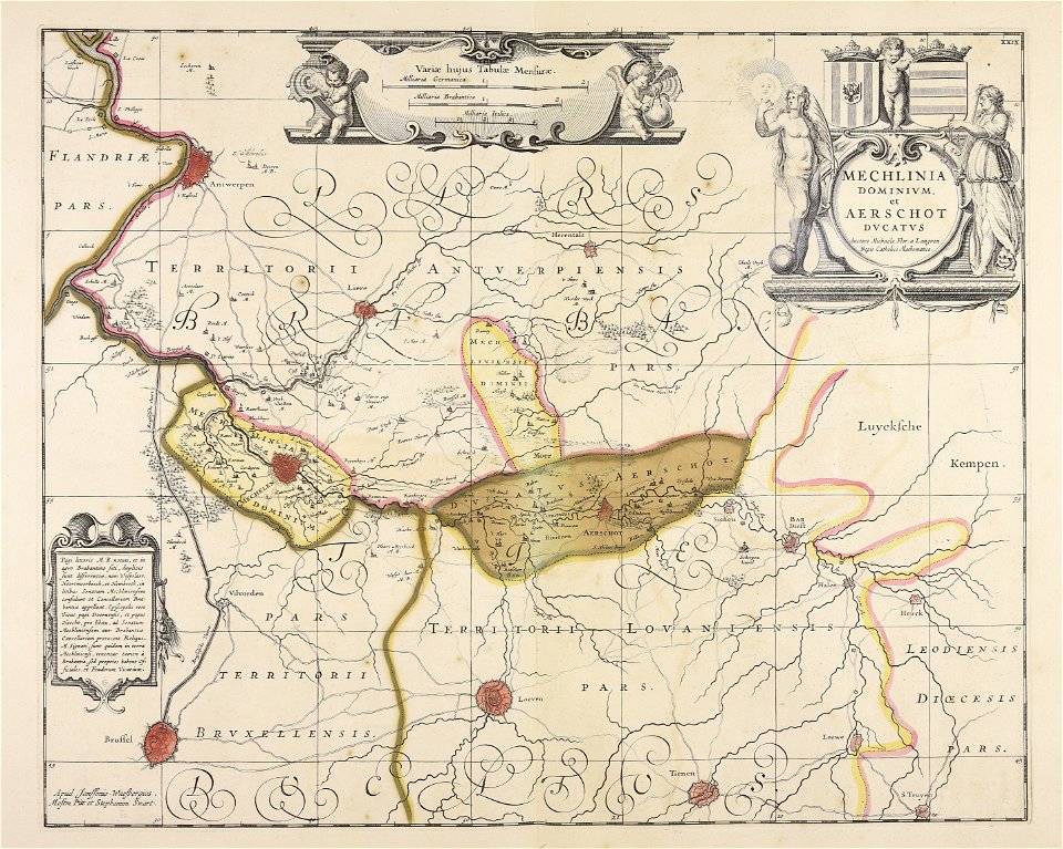
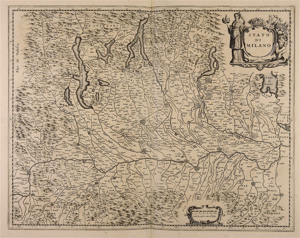
maps made in the 17th century
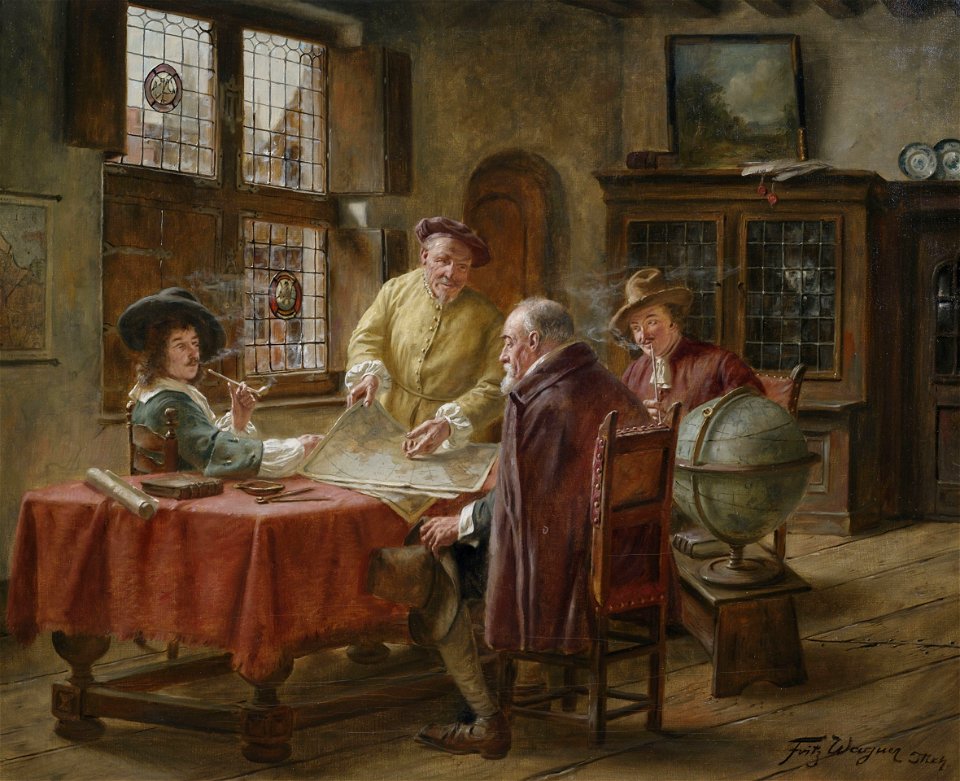
people with globes in art
people with maps in art
theatrum orbis terrarum (london 1606)
files from the bodleian libraries
files from the bodleian libraries
napoleonic wars
files from the bodleian libraries
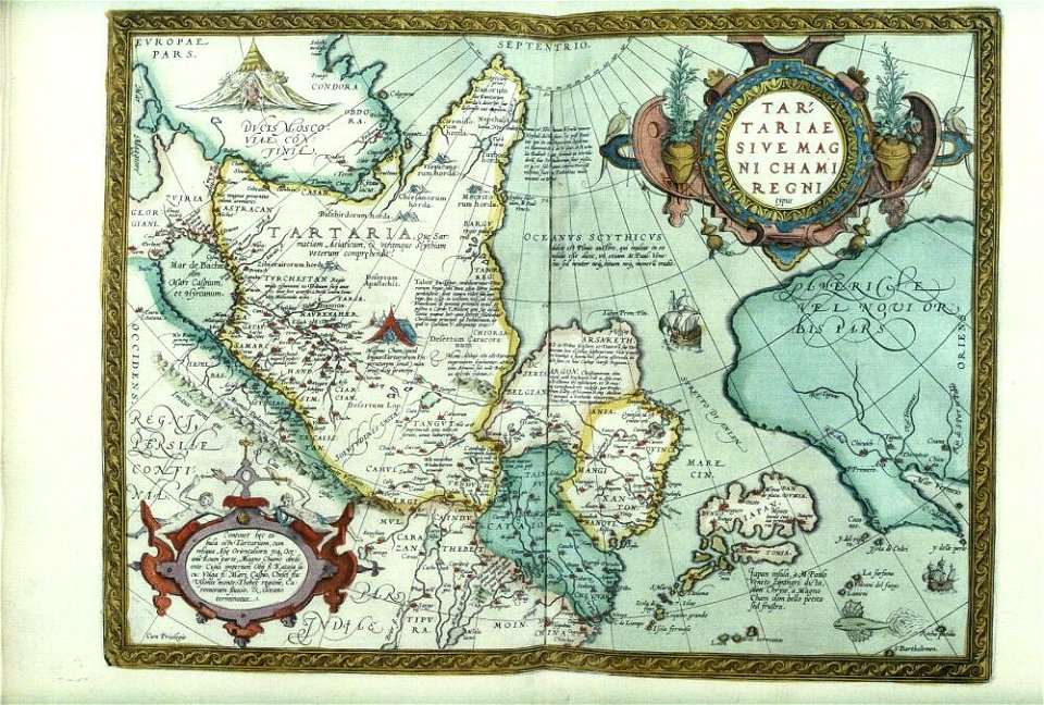
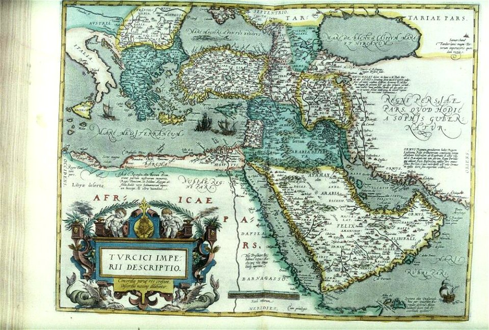
old maps of the middle east
atlantis magni tomus quartus (biblioteca comunale di trento)
maps made in the 17th century
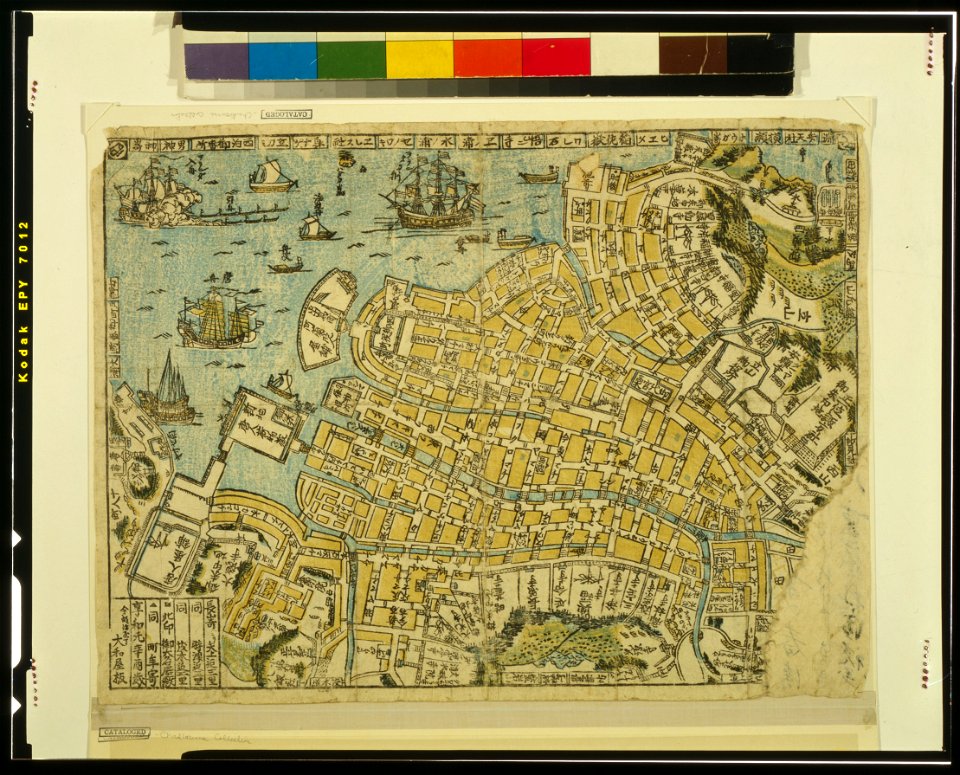
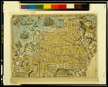
ukiyo-e by unknown artists
nagasaki-e
ukiyo-e by unknown artists
nagasaki-e
historical images of minsk
minsk
historical images of minsk
minsk
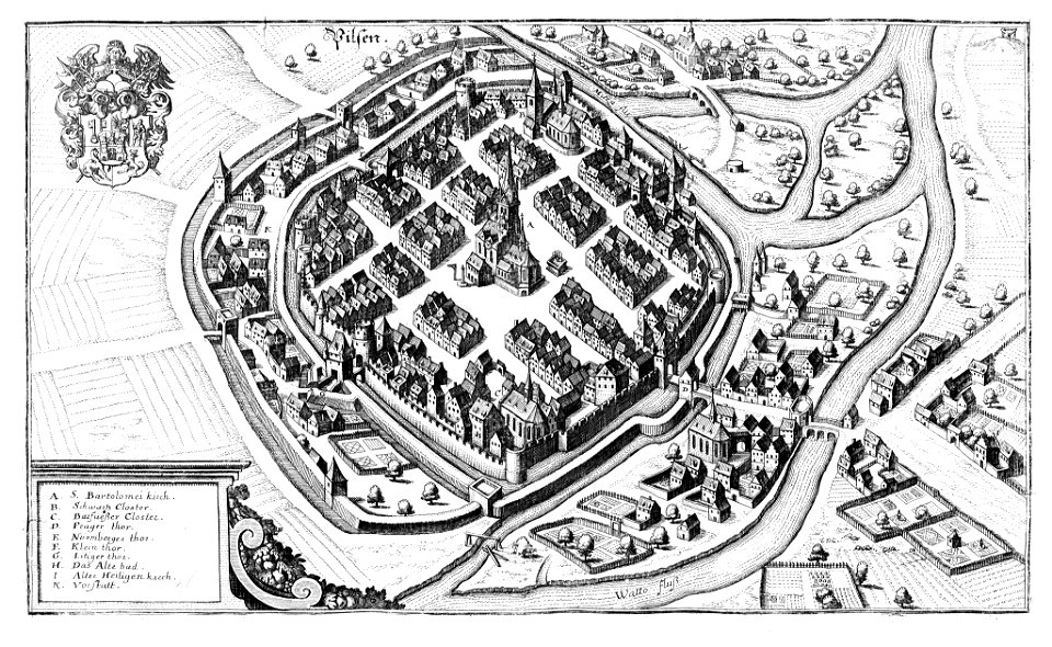
historical maps of plzeň
coats of arms of plzeň
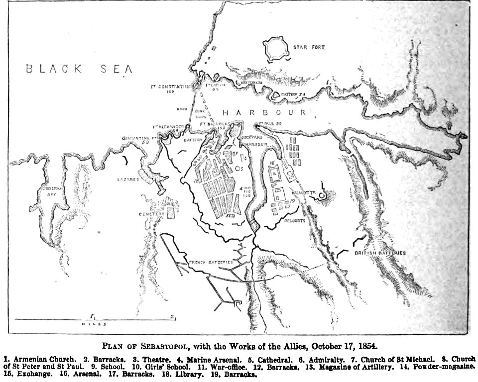
pictorial history of the russian war 1854-5-6 by george dodd
old maps of sevastopol
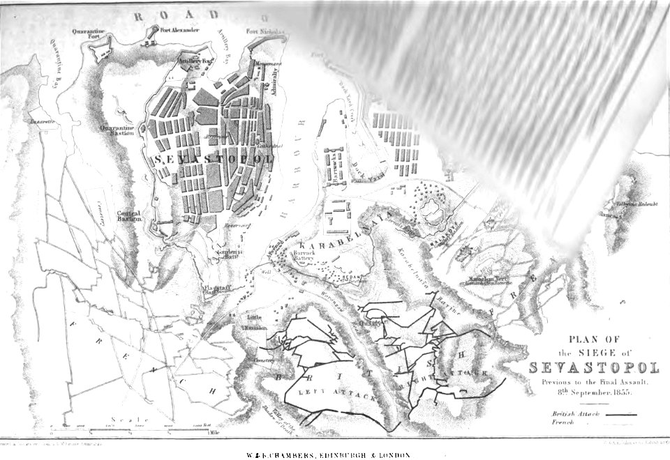
pictorial history of the russian war 1854-5-6 by george dodd
old maps of sevastopol
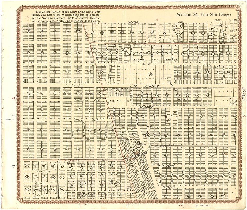
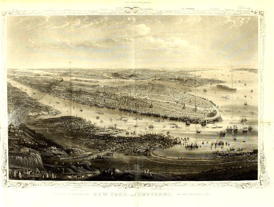
maps in the library of congress
california
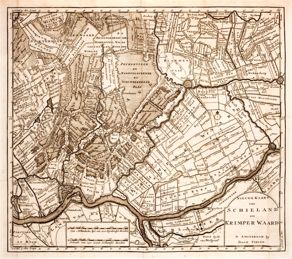
prints from isaak tirion hedendaegsche historie at the peace palace library
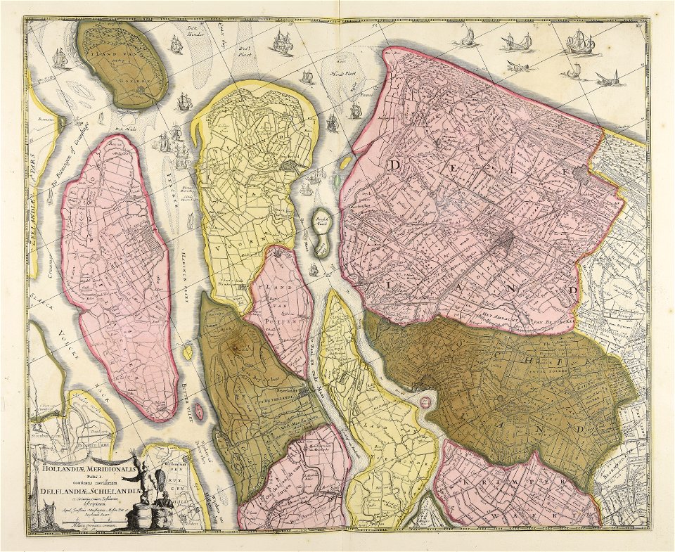
old maps of south holland
maps made in the 17th century
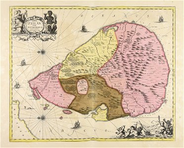
sri lanka
harvard university
ferrando bertelli
atlantis magni tomus secundus (biblioteca comunale di trento)
maps made in the 17th century
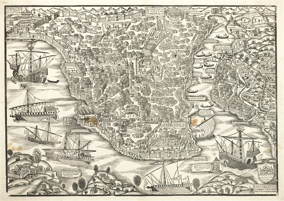
turkey in the 16th century
harvard university
atlantis magni tomus secundus (biblioteca comunale di trento)
maps made in the 17th century
old maps of vietnam
sài gòn
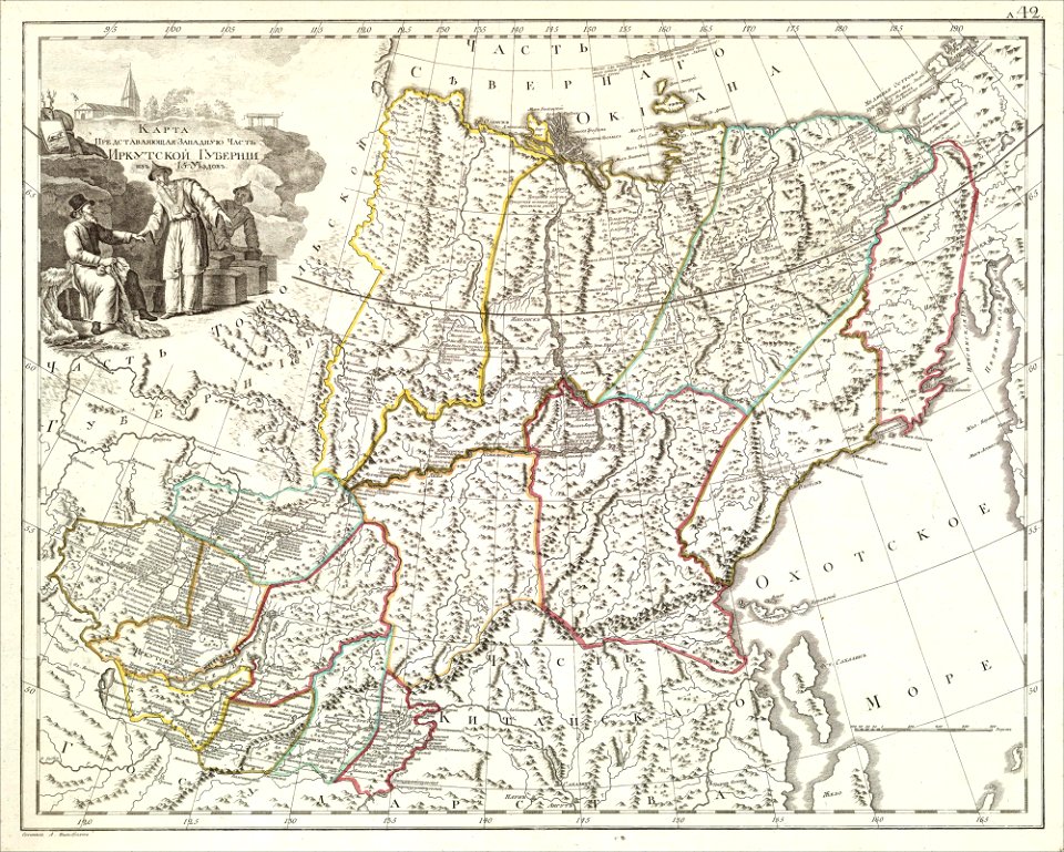
atlas of the russian empire (1800)
old maps of irkutsk governorate
engravings of topographia saxoniae inferioris
hildesheim in art
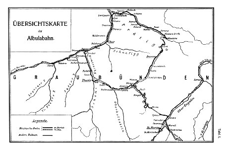
rail transport maps of switzerland
albula line
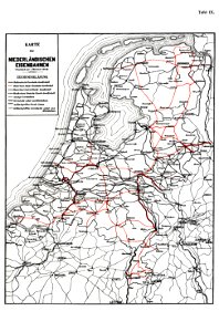
history of rail transport in the netherlands
enzyklopädie des eisenbahnwesens
kurtze beschreibung von republick venedig
17th-century engravings of towns
ou mémoires at the peace palace library
old maps of edinburgh
geographical illustrations by coronelli
old maps of the peloponnese
slave ships
printing
atlantis magni tomus quartus (biblioteca comunale di trento)
maps made in the 17th century
atlantis magni tomus quartus (biblioteca comunale di trento)
maps made in the 17th century
atlantis magni tomus quintus (biblioteca comunale di trento)
maps made in the 17th century
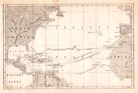
maps of voyages by christopher columbus
atlantic ocean
self-portrait (rembrandt, 1632)
dutch golden age painting
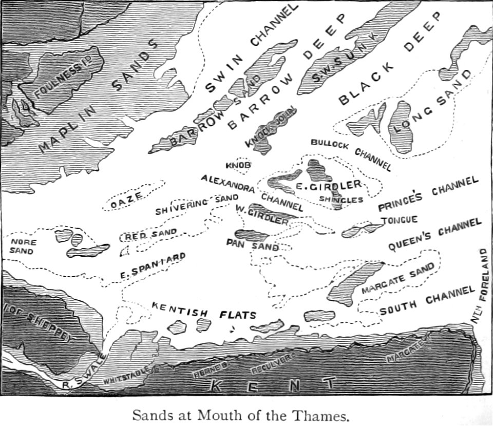
maps from the mechanical curator collection
buoy
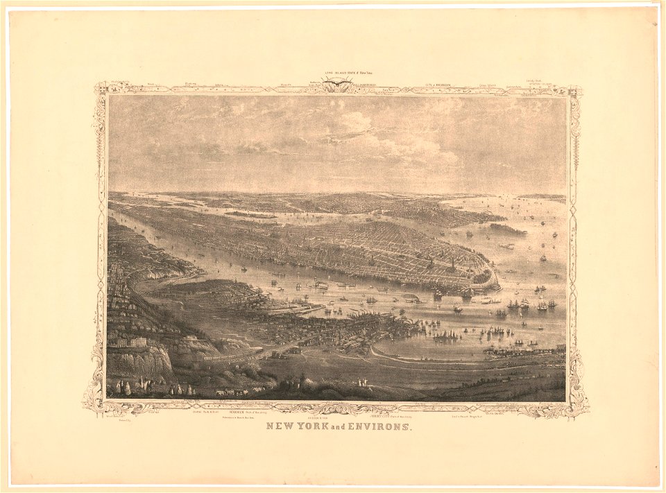
new jersey
hoboken
new jersey
hoboken
new jersey
hoboken
cornell university library
jr
self-portrait (rembrandt, 1632)
dutch golden age painting
river
roads
netherlands
wesel
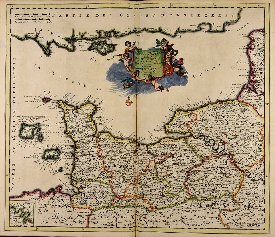
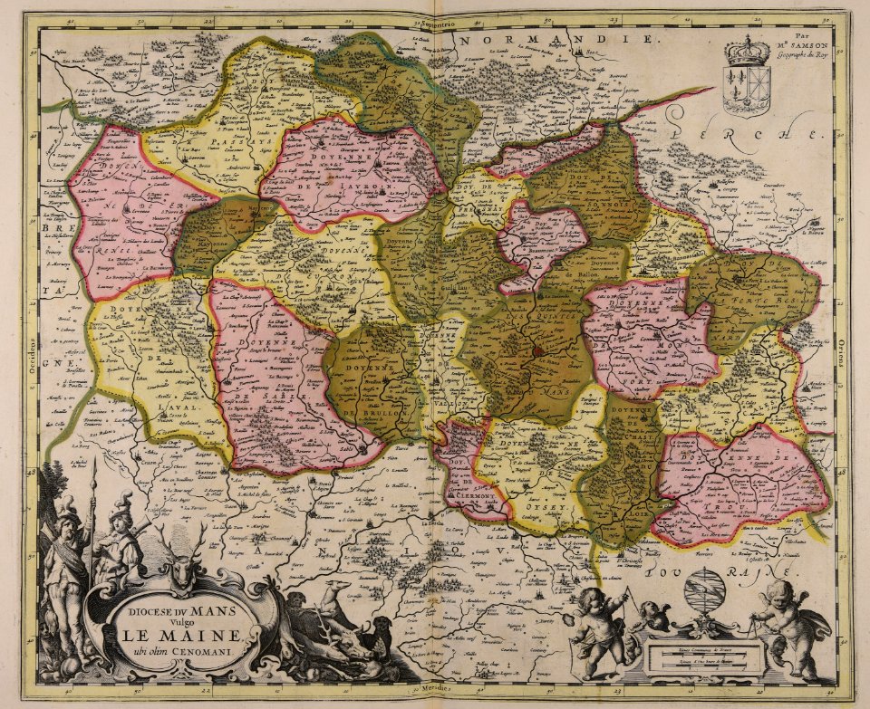
old maps of france
1730
nicolas iii de larmessin
gerardus mercator
collections of tiroler landesmuseum
route
dutch 18th-century prints in the rijksmuseum amsterdam
battles of the eighty years' war
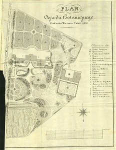
royal park in łazienki (warsaw)
historical maps of warsaw
maps made in the 17th century
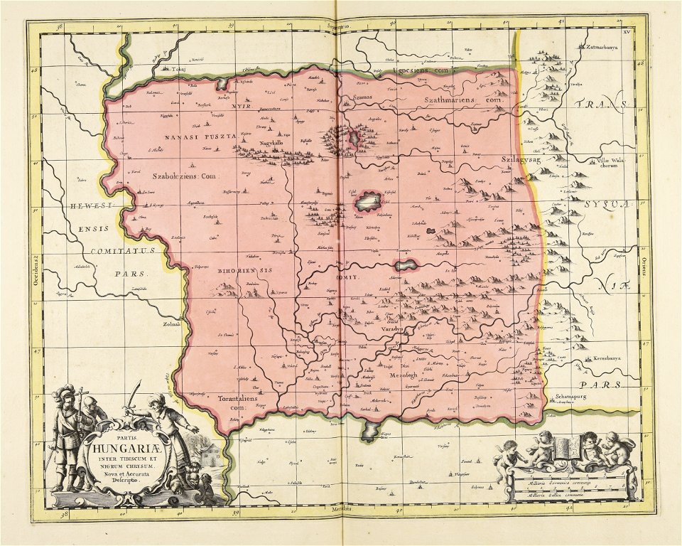
ungheria
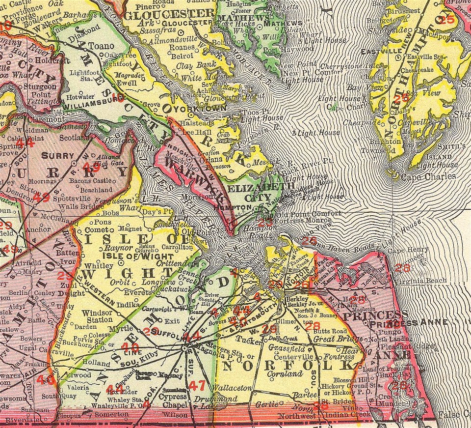
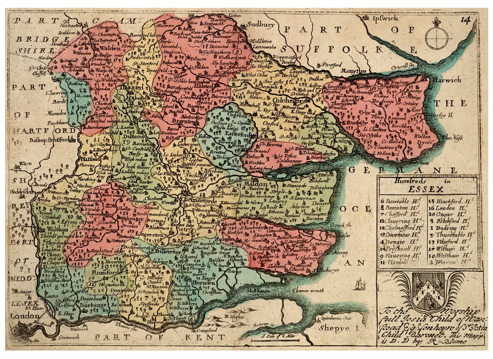
norfolk county
virginia
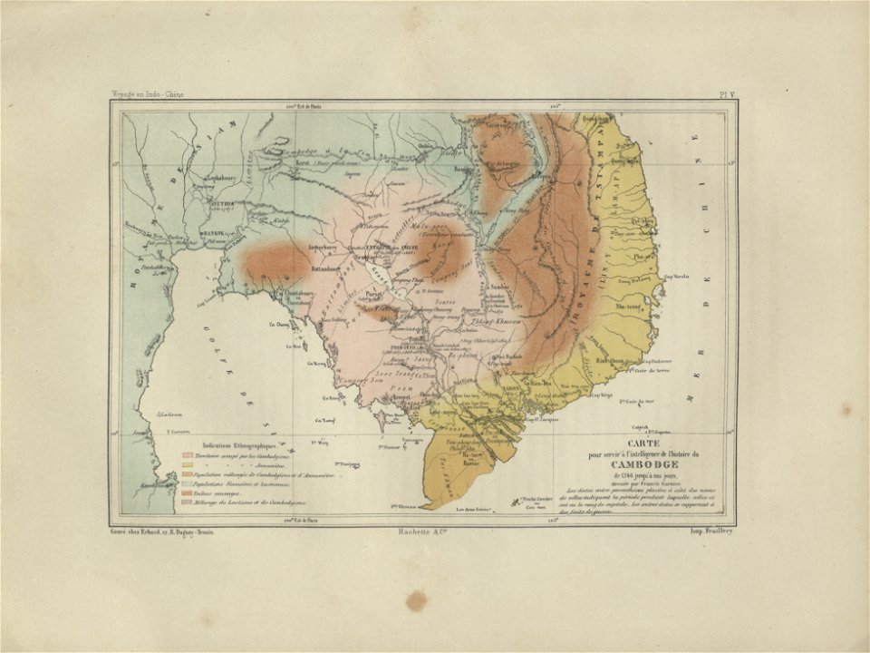
old maps of cambodia
francis garnier
maps and topographical views by joris hoefnagel
engravings in the hungarian national museum
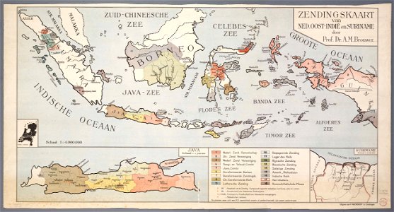
20th-century maps of indonesia
christian mission in indonesia
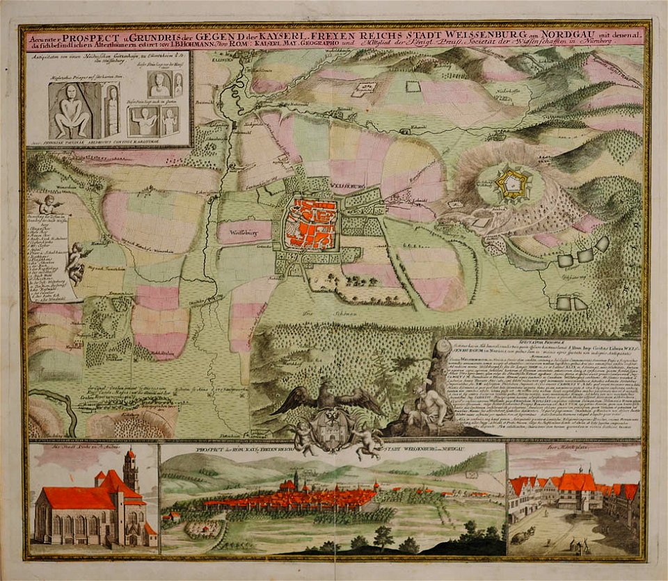
weißenburg in bayern in art
maps by homannsche erben
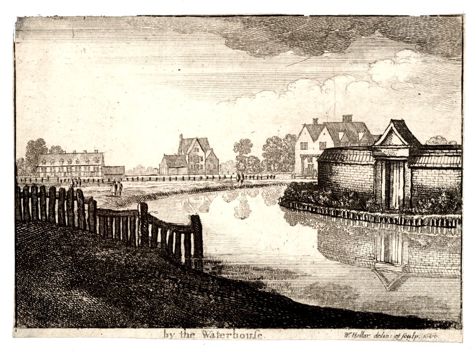
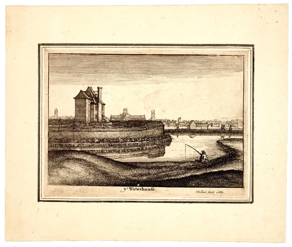
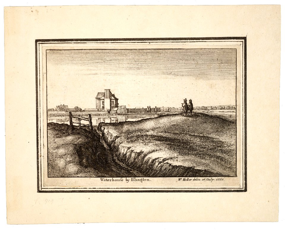
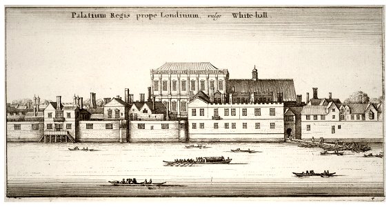
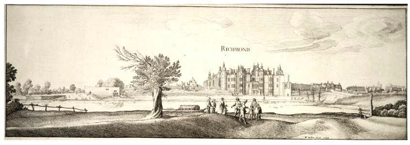
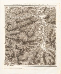
university of toronto wenceslas hollar digital collection
prints by wenzel hollar
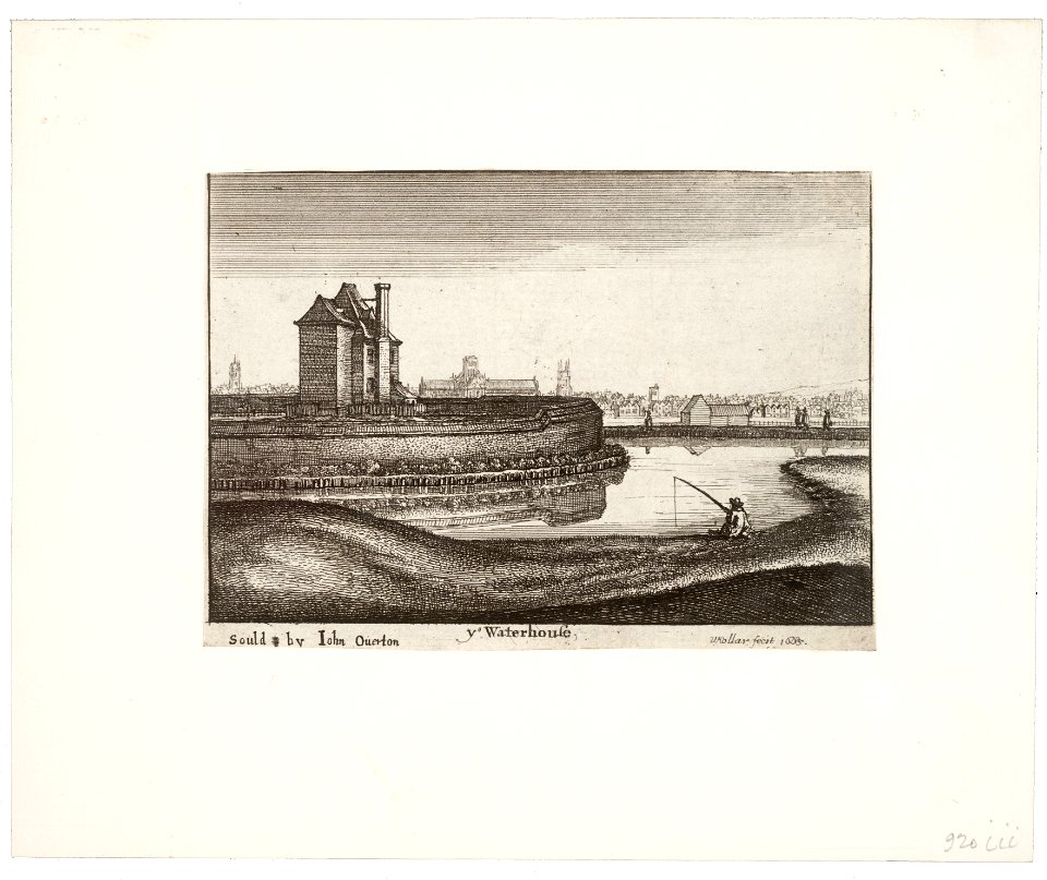
university of toronto wenceslas hollar digital collection
prints by wenzel hollar
university of toronto wenceslas hollar digital collection
prints by wenzel hollar
university of toronto wenceslas hollar digital collection
prints by wenzel hollar
university of toronto wenceslas hollar digital collection
prints by wenzel hollar
university of toronto wenceslas hollar digital collection
hundred (county division)
university of toronto wenceslas hollar digital collection
prints by wenzel hollar
university of toronto wenceslas hollar digital collection
prints by wenzel hollar
university of toronto wenceslas hollar digital collection
prints by wenzel hollar
university of toronto wenceslas hollar digital collection
prints by wenzel hollar
university of toronto wenceslas hollar digital collection
prints by wenzel hollar
maps by gerardus mercator
mercator celestial globe
dutch 17th-century prints in the rijksmuseum amsterdam
ijssel
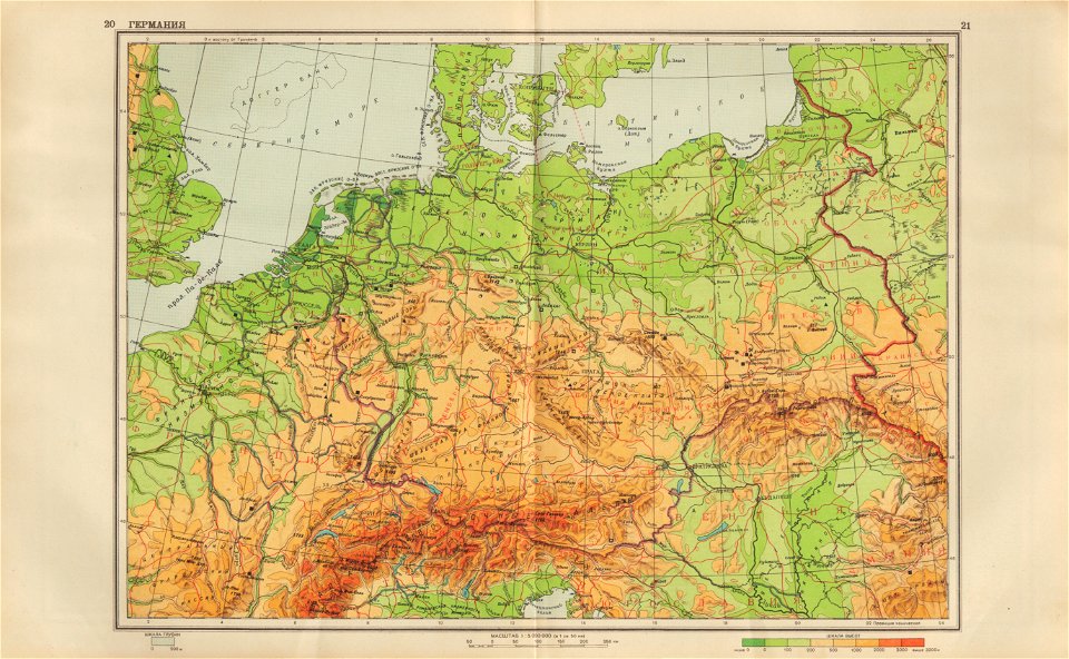
geographical atlas for the 5-6 grades of secondary school (1941)
old maps of the nazi germany
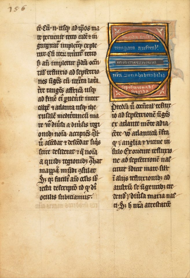
ms. ludwig xv 4 (getty museum) - bird book of hugo fouilloy
13th-century maps of the world
ms. ludwig xv 4 (getty museum) - bird book of hugo fouilloy
13th-century maps of the world
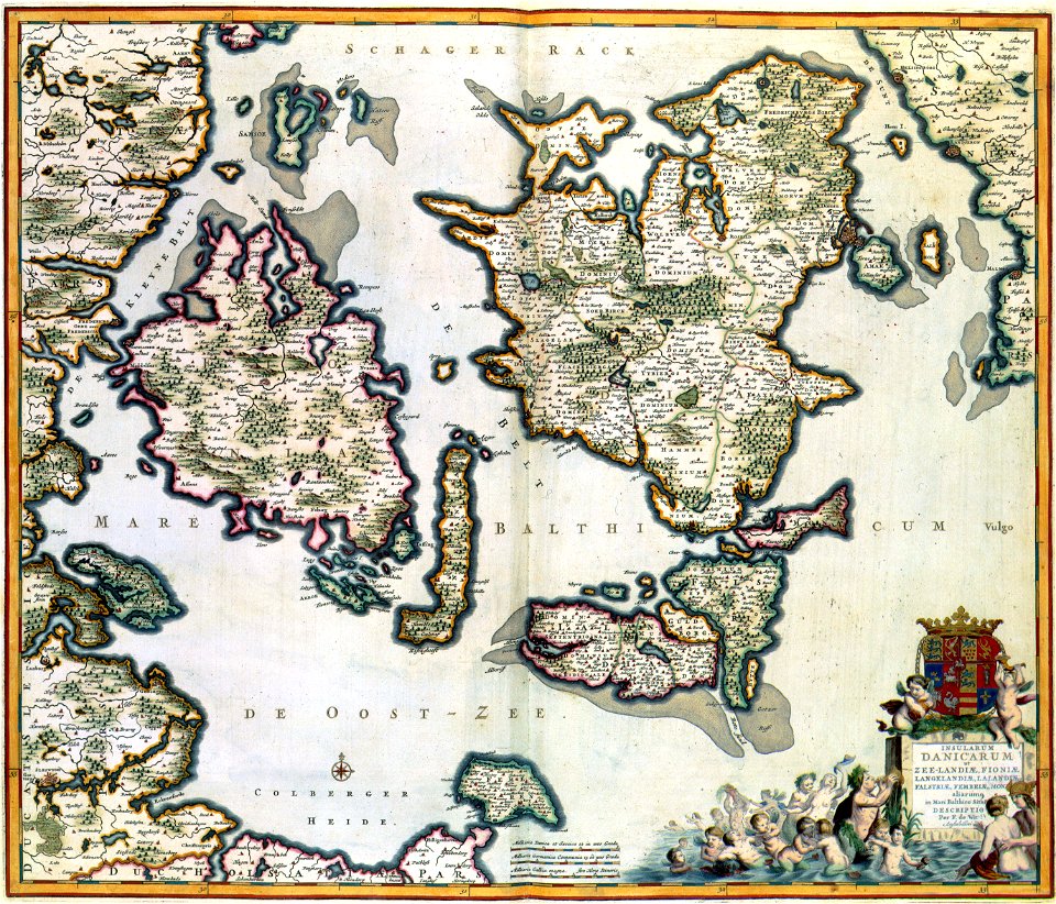
atlas van der hagen
copper engraving
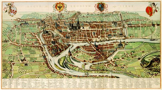
maps of liège in the 17th century
atlas van der hagen
maps with cartouches
atlas van der hagen
historic views of cities in germany by matthäus merian
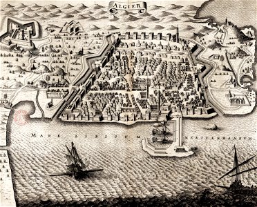
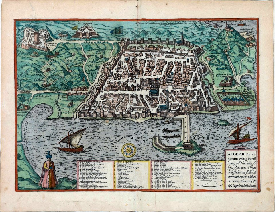
historical images of algiers
portrait of johan maurits of nassau-siegen by pieter nason (national museum in warsaw)
maps in art
historical images of algiers
braun & hogenberg
braun & hogenberg
maps of tours
atlantis magni tomus tertius (biblioteca comunale di trento)
17th-century maps of lower saxony
maps of the history of dalmatia
historical images of knin
old maps of slovakia
great turkish war
charte von schwaben (bohnenberger)
19th-century maps of bavaria
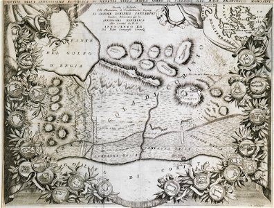
geographical illustrations by coronelli
old maps of the peloponnese
theatrum orbis terrarum (london 1606)
files from the bodleian libraries
theatrum orbis terrarum (london 1606)
files from the bodleian libraries
files from the bodleian libraries
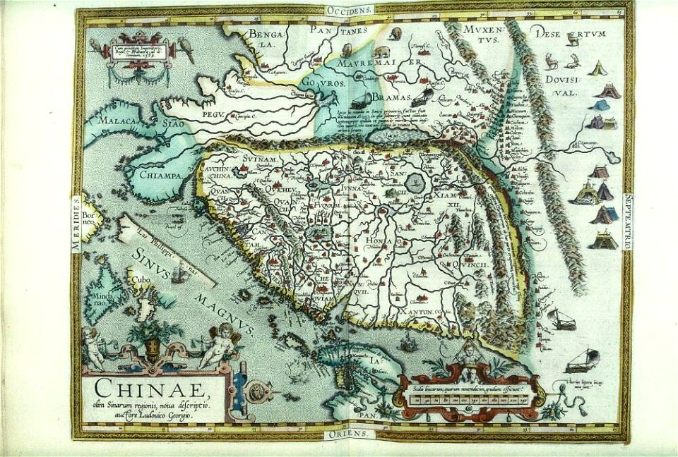
old maps of china
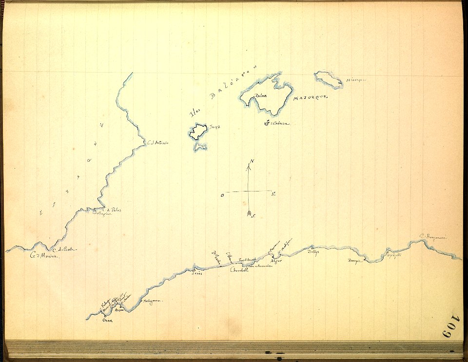
journal de relâches du croiseur ecole d'application l'iphigénie : campagne 1887-88
old maps of the balearic islands
old maps of turin
history of turin
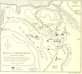
battle of inkerman
1895 drawings
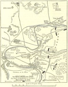
battle of villiers
1895 drawings
illustrated battles of the nineteenth century
1895 drawings
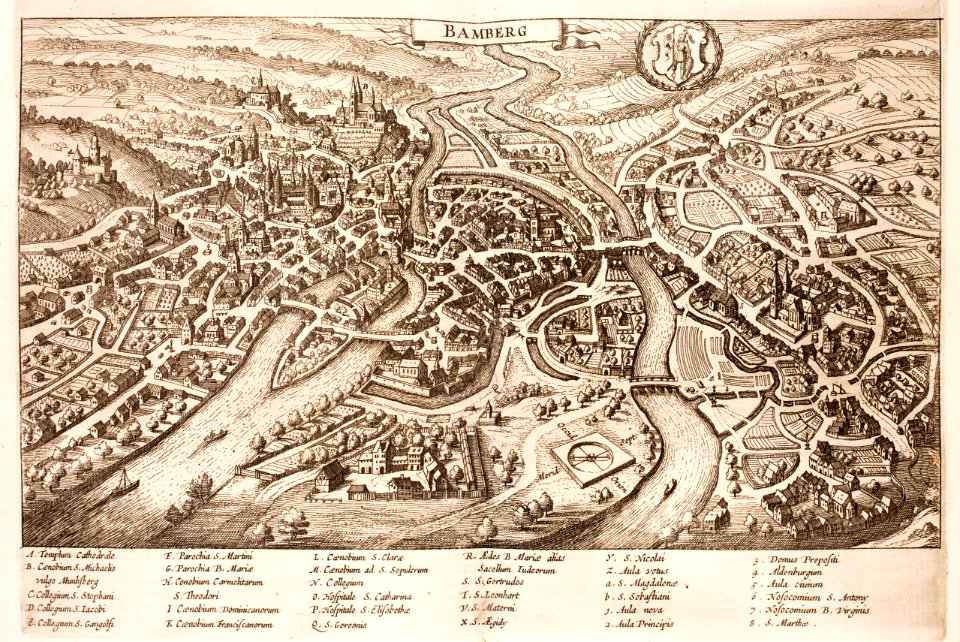
history of bamberg
bamberg
atlantis magni tomus quartus (biblioteca comunale di trento)
maps made in the 17th century
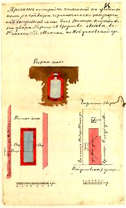
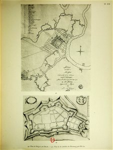
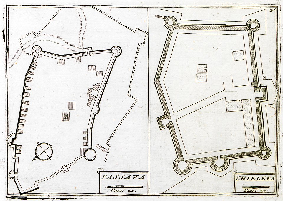
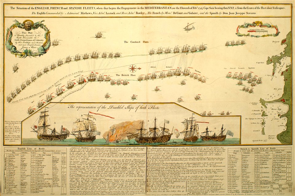
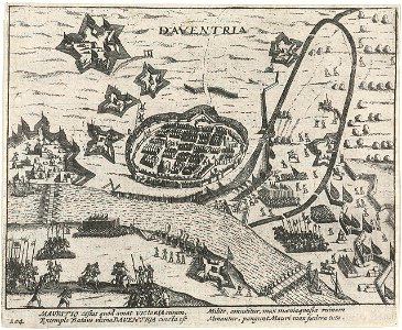
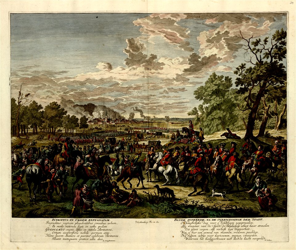
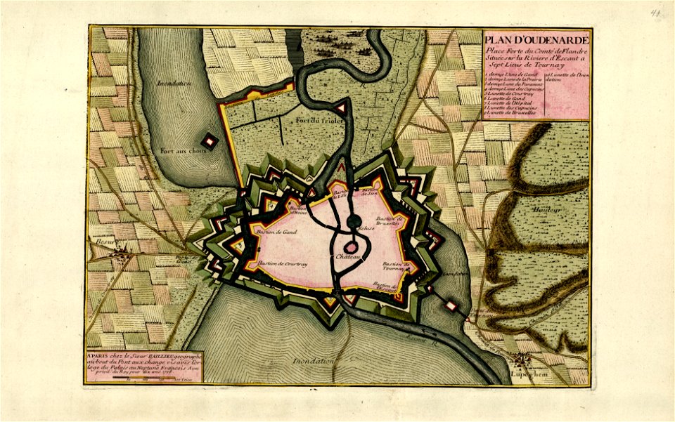
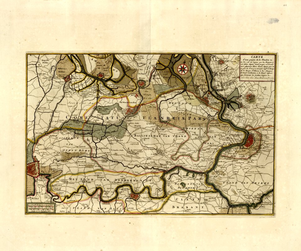
a collection of plans of fortifications and battles
maps in the library of congress
a collection of plans of fortifications and battles
maps in the library of congress
a collection of plans of fortifications and battles
maps in the library of congress
9201 - 9300 of 33,528
Next page
/ 336